
The Dingle Way is a village-to-village hiking trail tracing more than 100 miles around the Dingle Peninsula, a wildly remote section of western Ireland. With enchanting coastal and mountain scenery, not to mention a glut of archaeological sites, the trail takes you along some of Ireland’s best stretches of shoreline to the westernmost point in mainland Ireland.
## Hiking the Dingle Way: An Immersive Journey Through County Kerry
County Kerry, a jewel in Ireland’s crown, boasts the Dingle Peninsula, a region often lauded for its unspoiled beauty and authentic charm. While the Ring of Kerry, its southern counterpart, attracts a larger influx of visitors, the Dingle Peninsula offers a more intimate and culturally rich experience. The allure lies in its preservation of *Gaelige* (Gaelic), the ancient language that echoes through the valleys, and the presence of time-honored crofts nestled beneath the majestic mountains. Scattered across this sparsely populated landscape are ancient sites, whispering tales of a bygone era. The absence of a continuous road around the peninsula, coupled with fewer commercially driven attractions, has inadvertently safeguarded its unique character.
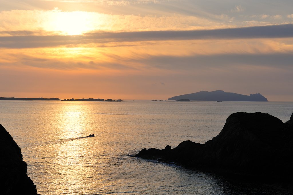
The Dingle Way, a celebrated long-distance trail, gracefully meanders through the most captivating parts of this peninsula. It guides hikers through the vibrant and spirited traditional towns of Tralee and Dingle, both offering a glimpse into the heart of Irish culture. The trail also encompasses the peninsula’s mountainous terrain, including the imposing Slieve Mish Mountains and the iconic Mount Brandon, providing challenging yet rewarding ascents. One of the most unforgettable sections of the Dingle Way traces Ireland’s dramatic coastline, stretching from Dingle to Slea Head, where the Atlantic Ocean crashes against rugged cliffs, creating a spectacle of raw natural power.
| Start/End Point | Distance | Highest Elevation | Days Needed | Difficulty | Supply Stops |
| Tralee | 111 miles | 2,165 feet | 6-8 days | Moderate | Tralee, Dingle |
## Delving Deeper: What Awaits You on the Dingle Way
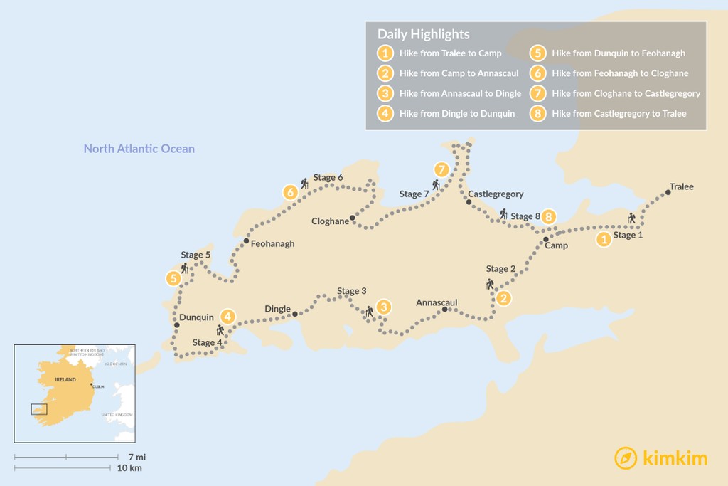
The Dingle Way, encompassing a total distance of 111 miles, is strategically segmented into eight distinct stages. These stages are thoughtfully planned, with each concluding in a village or town that offers essential facilities to cater to the needs of weary hikers. The availability of facilities can vary, ranging from basic amenities in the smaller, more remote villages to comprehensive services in larger towns such as Tralee and Dingle.
Each stage of the Dingle Way typically spans between 10 and 18 miles, requiring a reasonably fit adult approximately 6.5 to 8.5 hours to complete. It’s important to note for those seeking a complete circumnavigation that the Dingle Way does not encompass the entirety of the Dingle Peninsula. Specifically, the southern section stretching from Castlemaine to Inch Beach is not included within the official trail.
Beyond the principal towns of Tralee and Dingle, where outdoor supply shops are readily available, facilities along the Dingle Way can be limited. Accommodation and dining options, while present, may be sporadic, necessitating careful planning. The weather in this region is frequently characterized by wet and windy conditions. Therefore, it is crucial to pack appropriate wet weather and warm clothing to ensure a comfortable and safe hiking experience. While camping equipment is not essential, as lodging options are generally available within a two- to three-hour hike at any point along the trail, it is strongly advised to reserve accommodations well in advance, especially during the peak season from March to October, when demand is high.
In terms of overall difficulty, the Dingle Way is generally considered a moderate hike. However, certain sections present more demanding challenges, requiring a higher level of physical fitness and preparedness. These stretches often involve steep climbs, exposed sheer drops, and potentially poor visibility due to cloud cover. The segment from Feohanagh to Cloghane (Stage 6) is particularly noteworthy for its challenging terrain and unpredictable weather conditions. Hikers should exercise caution and be adequately prepared for these more difficult portions of the trail.
## Journey to the Starting Point: Getting to Tralee
Your adventure along the Dingle Way begins and concludes in Tralee, the main town and administrative hub of County Kerry. The official starting point of the trail is located near the Kerry County Museum in the serene Ashe Memorial Park. The Dingle Way is typically walked in a clockwise direction, commencing northwards from Tralee towards Camp, and then proceeding southwest in the direction of Annascaul.
Tralee enjoys convenient air connectivity via Kerry Airport, situated just 12 miles outside of town. The airport offers flights to and from Dublin, London-Luton, London-Stanstead, and Frankfurt-Hahn, providing easy access from major European cities. For those preferring rail travel, Tralee is connected to the Irish rail network via the central Tralee Casement Station. Trains run to Mallow, where passengers can transfer for services to Cork and Dublin. Services operate approximately every two hours from Monday to Saturday, with a reduced schedule on Sundays. Regular direct bus services also link Tralee with Cork, and with a change in Limerick, to Galway and Dublin, offering alternative transportation options.
In recent years, Tralee has undergone significant revitalization efforts, transforming itself into an appealing destination for visitors to explore and enjoy. Should your itinerary allow, consider spending some time in Tralee to appreciate its charms. However, if time is limited, it might be more rewarding to allocate additional time to Dingle (Stage 3), a town brimming with character and attractions.
## A Stage-by-Stage Exploration of the Dingle Way
### Stage 1: Tralee to Camp (11 miles)
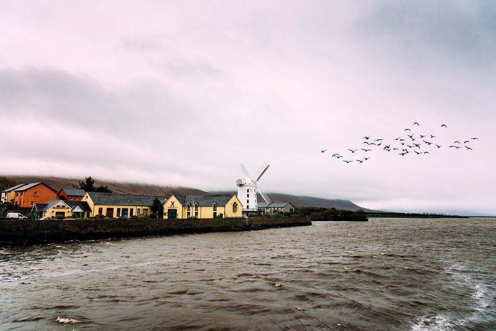
The initial stage of the Dingle Way follows a picturesque old canal towpath, leading to the charming suburb of Blennerville, a delightful village offering various accommodation options. Blennerville is also renowned as the home of Ireland’s largest working windmill, a testament to the region’s rich industrial heritage. As the trail progresses, it gradually ascends into the Slieve Mish Mountains, providing breathtaking panoramic views. Along the way, hikers will pass through Tonavene and encounter the significant archaeological site of Killeton Oratory, before finally reaching the welcoming village of Camp.
### Stage 2: Camp to Annascaul (10.5 miles)
This segment of the Dingle Way leads you through the only substantial forest encountered along the entire route, a refreshing contrast to the coastal landscapes. The path traverses a saddle between the imposing Knockbrack and Corrin mountains, offering stunning vistas of the surrounding countryside. Eventually, the trail descends towards the famous Inch Beach, immortalized in the iconic World War I movie, *Ryan’s Daughter*. From the beach, the route veers inland, following a network of smaller lanes that eventually lead to the charming village of Annascaul. History enthusiasts and those seeking refreshment should be sure to visit the South Pole Inn, a pub owned by the legendary Antarctic explorer Tom Crean, adorned with fascinating memorabilia from his remarkable expeditions.
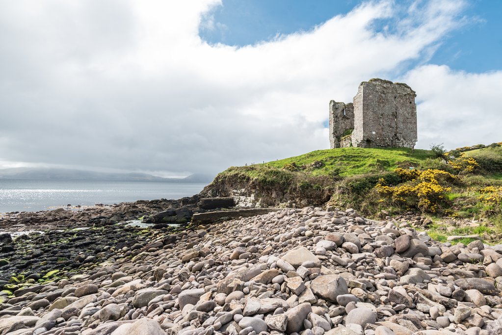
### Stage 3: Annascaul to Dingle (13.5 miles)
The path on this day takes you past the evocative ruins of Minard Castle, offering captivating beach views stretching across to the distant Ring of Kerry. The trail then meanders through Lispole and traverses the renowned Conor’s Pass, a dramatic mountain pass that provides unparalleled panoramic views. Finally, the path descends into the vibrant town of Dingle, a bustling hub brimming with character.
### Stage 4: Dingle to Dunquin (12.5 miles)
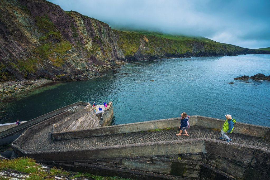
This segment of the Dingle Way unveils some of the most breathtaking coastal scenery in all of Ireland. The path gracefully winds past Ventry Harbor, a picturesque inlet teeming with activity, and the dramatic Slea Head headland, a prominent landmark offering stunning views of the Atlantic Ocean. From Slea Head, you can choose to deviate slightly from the main trail and venture out to Dunmore Head, the westernmost point of Ireland, a truly unique and unforgettable experience. From this vantage point, you’ll be rewarded with spectacular views of the Blasket Islands, the westernmost land in all of Europe. A ferry service from Dunquin allows visitors to explore these intriguing islands, adding another dimension to your Dingle Way adventure.
### Stage 5: Dunquin to Feohanagh (13.5 miles)
On this stage, the trail primarily hugs the coastline, offering continuous views of the rugged cliffs and the vast expanse of the Atlantic Ocean. The path passes through Murreagh, where a worthwhile side trip leads to the enigmatic archaeological site of Gallarus Oratory, a remarkably well-preserved early Christian church. The trail continues through Ballydavid before arriving in Feohanagh. If accommodation in Feohanagh is fully booked, consider staying overnight in the nearby village of Ballydavid.
### Stage 6: Feohanagh to Cloghane (13 miles)
This stage is widely considered the most challenging section of the Dingle Way, requiring a significant ascent up the slopes of Brandon Mountain via Masatiompan. The trail then loops around the idyllic village of Brandon, where lodging options are available. Continuing onwards, the path skirts the lower slopes of Mount Brandon, eventually leading to the village of Cloghane.
### Stage 7: Cloghane to Castlegregory (18 miles)
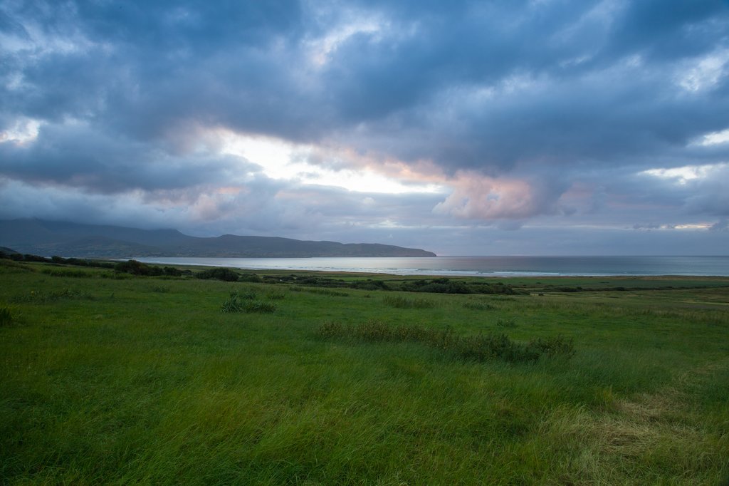
Stage seven is the longest of the entire Dingle Way hike, but fortunately, it is mostly flat terrain, making it a relatively easier day despite the distance. The path follows Fermoyle Strand, the longest stretch of beach in Ireland, where several accommodations are conveniently located just a short distance from the shoreline. The trail then reaches the top of a distinctive hammerhead-shaped peninsula, offering breathtaking views of the Magharee Islands. The route continues southwards along the eastern side of the peninsula, eventually reaching the welcoming village of Castlegregory.
### Stage 8: Castlegregory to Tralee (16.5 miles)
After traversing a flat coastal section, the trail reaches Camp, where it rejoins the original outward route back to Tralee, completing the Dingle Way circuit.
## Unwind and Explore: Dingle – A Town Worthy of Exploration
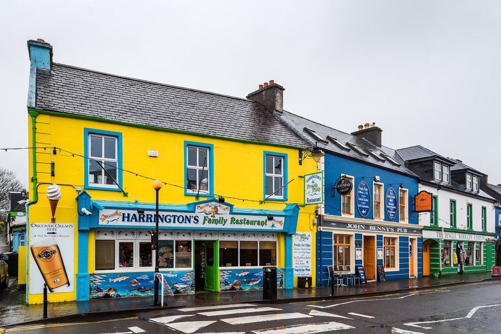
Dingle, a lively town marking the end of Stage 3, is undoubtedly the most rewarding place to pause your hiking adventure for a day or two and immerse yourself in its unique atmosphere.
### Things to Do in Dingle
Dingle is famously associated with Fungie, a beloved dolphin who frequents the waters around the town. Fungie’s remarkable affinity for human interaction makes him a rare and special attraction. Numerous boat trips offer the opportunity to observe Fungie frolicking in the bay. Dingle Oceanworld, home to Ireland’s largest collection of sharks, provides an engaging experience. To cap off your day, sample the local spirits at the Dingle Distillery, which produces whiskey, gin, and vodka, and offers daily tours and tastings.
### Where to Stay in Dingle
Dingle offers a wide array of lodging options, providing a welcome opportunity to indulge in a hotel stay after several days of hiking. Pubs, guesthouses, and bed-and-breakfasts are also readily available. Greenmount House, an architect-designed guesthouse with an enviable location overlooking the town center and offering stunning bay views, is a standout choice. Alternatively, consider the 19th-century stone-built Quayside B&B, a characterful lodging option located in the heart of town.
### Where to Eat (and Drink) in Dingle
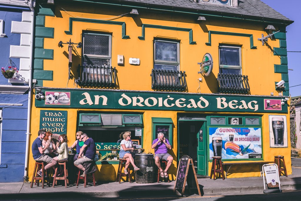
Foxy John’s, situated at the corner of Main St and Green St, is a Dingle institution and a must-visit pub. This traditional watering hole uniquely combines a bar with a jumbled hardware store. The Boat Yard Restaurant & Bar offers fantastic harbor views and a daily selection of local seafood. McCarthy’s Bar (Goat St.) is one of several venues that feature regular live music performances.
B-1246